Whittier, CA
Whittier (/ˈhwɪtiər/) is a city in Southern California in Los Angeles County, part of the Gateway Cities. The 14.7-square-mile (38.0 km2) city had 87,306 residents as of the 2020 United States census, an increase of 1,975 from the 2010 census figure. Whittier was incorporated in February 1898 and became a charter city in 1955.[6] The city is named for the Quaker poet John Greenleaf Whittier and is home to Whittier College. The city is surrounded by three unincorporated areas sharing the Whittier name, West Whittier-Los Nietos, South Whittier, and East Whittier, which combined are home to a larger population than Whittier proper.

Etymology
In the founding days of Whittier, when it was a small, isolated town, Jonathan Bailey and his wife, Rebecca, were among the first residents. They followed the Quaker religious faith and practice and held religious meetings on their porch. Other early settlers, such as Aquila Pickering, espoused the Quaker faith. As the city grew, the citizens named it after John Greenleaf Whittier, a respected Quaker poet, and deeded a lot to him. Whittier wrote a dedication poem and is
honored today with statues and a small exhibit at the Whittier Museum; a statue of him sits in Whittier’s Central Park, and another representing his poem “The Barefoot Boy”[7]used to reside by the City Hall and is now in front of the main library. Whittier never set foot there, but the city still bears his name and is rooted in the Quaker tradition.[6]

HISTORY
The Gabrielino first inhabited the area.[8]
Whittier’s roots can be traced to Spanish soldier Manuel Nieto.[9] In 1784, Nieto received a Spanish land grant of 300,000 acres (1,200 km2), Rancho Los Nietos, as a reward for his military service and to encourage settlement in California.[6] The area of Nieto’s land grant was reduced in 1790 as the result of a dispute with Mission San Gabriel. Nonetheless, Nieto still had a claim to 167,000 acres (680 km2) stretching from the hills north of Whittier, Fullerton, and Brea, south to the Pacific Ocean, and from what is known today as the Los Angeles River east to the Santa Ana River. Nieto built a rancho for his family near Whittier, purchased cattle and horses for his ranch, and planted cornfields. When Nieto died in 1804, his children inherited their father’s property.
At the time of the 1840s Mexican–American War, much of the land that would become Whittier was owned by Pio Pico, a rancher and the last Mexican governor of Alta California.[6] Pio Pico built a hacienda here on the San Gabriel River, known today as Pio Pico State Historic Park.[6] Following the Mexican–American War, German immigrant Jacob F. Gerkens paid $234 to the U.S. government to acquire 160 acres (0.6 km2) of land under the Homestead Act and built the cabin known today as the Jonathan Bailey House.[10] Gerkens would later become the first chief of police of the Los Angeles Police Department. Gerkens’ land was owned by several others before a group of Quakers purchased it and expanded it to 1,259 acres (5 km2), intending to found a Quaker community. The area soon became known as a thriving citrus ranching region, with “Quaker Brand” fruit shipped all over the United States. Beginning in 1887, walnut trees were planted, and Whittier became the largest walnut grower in the United States.[6][9] In addition to walnuts and citrus, Whittier was also a significant producer of pampas grass.
For many years, the sole means of transport from this area to Los Angeles was on foot or via horse and wagon over rough dirt roads, impeding settlement, development, and the export of agriculture.[11] Thus in 1887 “enterprising and aggressive businessmen” contracted with the Southern Pacific Railroad to build the first railroad spur to Whittier, including a depot.[12] The businessmen covered the $43,000 construction cost for the six-mile spur, which branched off from the Southern Pacific mainline at a junction near what is now Studebaker Road between Firestone Boulevard and Imperial Highway.[13] By 1906, 650 carloads of oranges and 250 carloads of lemons were shipped annually by rail. In 1904, the Pacific Electric opened the trolley line known as “Big Red Cars” from Los Angeles to Whittier. In the first two decades, over a million passengers a year rode to and from Los Angeles on the Whittier Line.[6] After World War II, Whittier grew rapidly. The sub-dividing of orange groves began, driven by housing shortages in southern California. In 1955, the new Civic Center complex was completed, and the City Council met in new chambers for the first time on March 8, 1955. The city continued to grow as the City annexed portions of Whittier Boulevard and East Whittier. The 1961 annexation added over 28,000 people to the population, bringing the total to about 67,000.[6]
QUAKERS
The first Quaker meetings were held on the front porch of the Jonathan Bailey House.[10] Eventually, as more Quakers arrived, the need for an actual Meeting House arose, and the first Quaker meeting house was built on the corner of Comstock Avenue and Wardman Street in 1887. The meeting soon outgrew this 100-seat meeting house, and a new larger building was erected on the corner of Philadelphia Street and Washington Avenue in 1902. By 1912, membership had grown to 1,200, and a third building was dedicated on the same site in 1917. With a capacity of 1,700, the 1917 meeting house featured a balcony and was constructed of brick with mahogany paneling and pews. The present meeting house, dedicated in 1975, features many architectural elements and materials from the 1917 building, including the stained glass windows and mahogany interior.[14] The Quakers also founded Whittier Academy (later Whittier College), and additional meetings met in East Whittier and at Whittier College’s Mendenhall. The Mendenhall and East Whittier meetings kept the silent meeting longer than the main church.
WHITTIER NEIGHBORHOODS
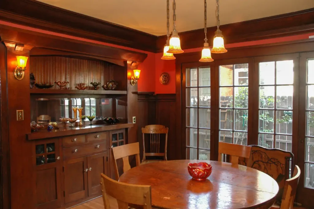
There are several neighborhoods in Whittier. The area centered around Philadelphia Street and Greenleaf Avenue is known as Uptown Whittier and contains the traditional central business core. Just north of Uptown Whittier are the neighborhoods known as Central Park and Hadley-Greenleaf. They have been designated historic districts by the city Historic Resources Commission and comprise most of the Whittier Historic Neighborhood Association area. These districts contain many Craftsman and Spanish Colonial Revival homes. In and abutting the hills north of the historic districts is Starlite Estates. The area surrounding Whittier College is known as College Hills and was also recently designated a historic district, as it has a small cluster of homes along Earlham Drive. The area east of College Avenue is called East Whittier. East Whittier was an unincorporated agricultural community until the postwar era. The eastern parts of East Whittier, developed in the 1950s and 1960s, are known as Friendly Hills, which was developed at the same time as Murphy Ranch and Leffingwell Ranch. Friendly Hills and Murphy Ranch are generally considered north of Whittier Boulevard, while Leffingwell Ranch is south of the boulevard. The area at the extreme east of Whittier is occasionally called Sunglow.
